2024 Redistricting

The Chief Ladiga Trail stands as Alabama’s inaugural extended rails-to-trails endeavor, interlinking the cities of Anniston, Weaver, Jacksonville, and Piedmont as it traverses Calhoun and Cleburne Counties. Offering a safe, motor-free avenue for travel, exercise, and leisure amidst the great outdoors, this trail showcases a scenic journey through streams, wetlands, forests, farmlands, and mountains, catering to families and outdoor enthusiasts alike.
Anniston’s trail extension stretches an additional 7.1 miles, bringing the Chief Ladiga Trail’s total length to approximately 39.5 miles. The Chief Ladiga seamlessly connects Anniston’s Multimodal Amtrak Station to the state of Georgia’s Silver Comet Trail, forming the longest paved pedestrian pathway in the United States by becoming an expansive 105+/- mile paved trail.
We offer primitive campgrounds at our Michael Tucker Park Chief Ladiga Trailhead. For information and to view a map of the campground click this link, Campground Rules & Map.
For more information on the Michael Tucker Park and Campground, contact the Parks and Recreation Department’s Aquatic & Fitness Center at 256-847-7349.
To reserve a camp site online, please click the portal below:
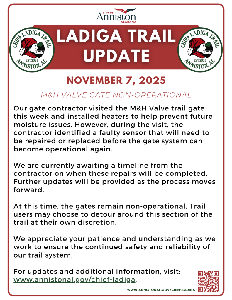
Our gate contractor visited the M&H Valve trail gate this week and installed heaters to help prevent future moisture issues. However, during the visit, the contractor identified a faulty sensor that will need to be repaired or replaced before the gate system can become operational again.
We are currently awaiting a timeline from the contractor on when these repairs will be completed. Further updates will be provided as the process moves forward.
At this time, the gates remain non-operational. Trail users may choose to detour around this section of the trail at their own discretion.
We appreciate your patience and understanding as we work to ensure the continued safety and reliability of our trail system.
Citizens may report trail safety concerns or trail maintenance needs at the link below, or by scanning the QR code with their smartphone camera.
PLEASE NOTE: These online portals are only for portions of the Ladiga within the City of Anniston. For concerns over portions of the Ladiga Trail that run through Jacksonville or Piedmont, please contact the numbers below:

The City of Anniston is proud to unveil the completed extension of the Chief Ladiga Trail. The extended trail now includes key features such as:
Spanning north to south through the heart of Anniston, this enhanced trail system promotes eco-friendly transportation, healthy living, and regional tourism. Whether you’re biking, walking, or commuting, the Chief Ladiga Trail offers a vibrant route through the city’s rich landscapes and historic corridors.
View detailed maps at the links here:
Directions: From I-20, take Exit 185 and head north about 10 miles through Anniston on Route 1/Quintard Avenue; bear right on McClellan Boulevard/Route 21 on the north side of town. A few miles past the split, turn left on Weaver Road; continue about a mile, then turn left again on Holly Farms Road to the well-marked Woodland Park trailhead.
Anniston’s Michael Tucker Park currently serves as the southern terminus of the Chief Ladiga Trail. The park was named in memory Dr. Michael Tucker, a noted Anniston physician and long-time bicycle enthusiast. Nestled within a pecan grove, the park offers parking the trail, a gazebo, a drinking fountain, 16 site primitive campground and rest-room facilities.
For information and to view a map of the campground click this link, Campground Rules & Map. To make campground reservations, visit our rental page here: Parks & Recreation Rentals.
For more information on the Chief Ladiga Trail or Michael Tucker Park and Campground, contact the Parks and Recreation Department’s Aquatic & Fitness Center at 256-847-7349.
Not sure where to stay, eat or shop? The Calhoun County Chamber of Commerce can help! Regardless of whether or not you’re planning on visiting for a day or a week, Visit Calhoun County is your one-stop for information stop on all things Calhoun County. Follow the links to find what you need:

The Anniston Multimodal Center, otherwise known as our Amtrak Station, is located at the end of the Chief Ladiga Trail. This provides trail-goers with a seamless rails-to-trails experience. Learn more about the station, and purchase tickets online, below:
Directions:

Hours:
| MONDAY | 9:30 AM – 11:00 AM, 6:00 PM – 7:30 PM |
| TUESDAY | 9:30 AM – 11:00 AM, 6:00 PM – 7:30 PM |
| WEDNESDAY | 9:30 AM – 11:00 AM, 6:00 PM – 7:30 PM |
| THURSDAY | 9:30 AM – 11:00 AM, 6:00 PM – 7:30 PM |
| FRIDAY | 9:30 AM – 11:00 AM, 6:00 PM – 7:30 PM |
| SATURDAY | 9:30 AM – 11:00 AM, 6:00 PM – 7:30 PM |
| SUNDAY | 9:30 AM – 11:00 AM, 6:00 PM – 7:30 PM |
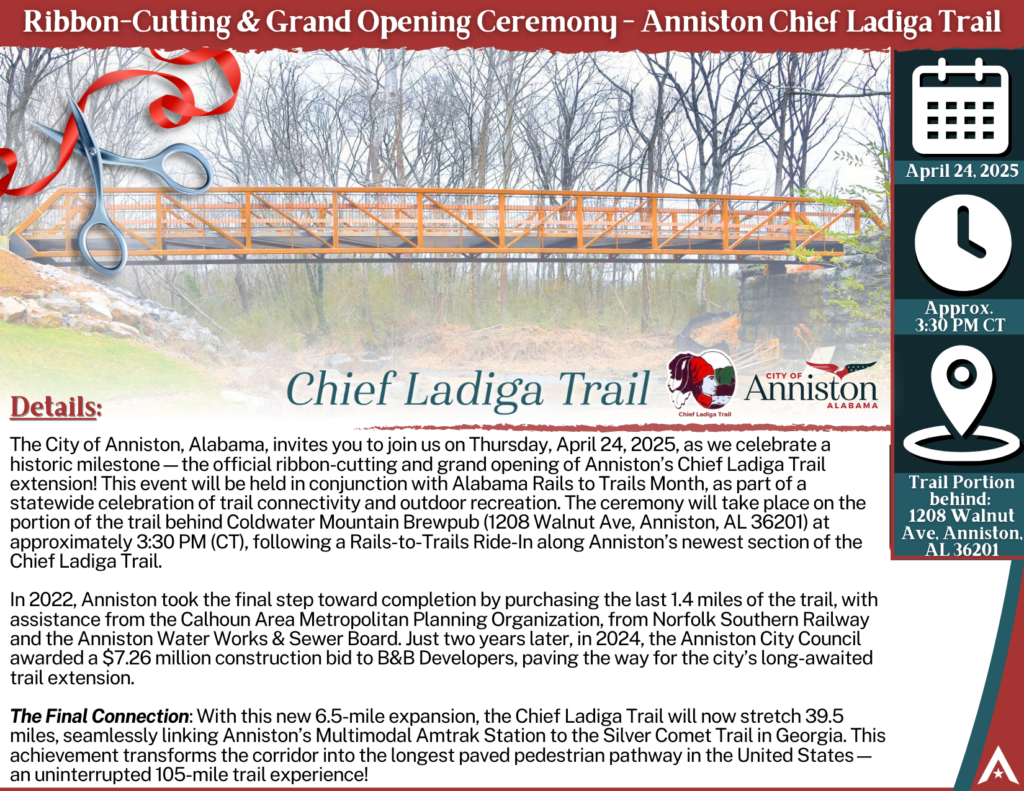
The City of Anniston, Alabama, invites you to join us on Thursday, April 24, 2025, as we celebrate a historic milestone—the official ribbon-cutting and grand opening of Anniston’s Chief Ladiga Trail extension! This event will be held in conjunction with Alabama Rails to Trails Month, as part of a statewide celebration of trail connectivity and outdoor recreation. The ceremony will take place on the portion of the trail behind Coldwater Mountain Brewpub (1208 Walnut Ave, Anniston, AL 36201) at approximately 3:30 PM (CT), following a Rails-to-Trails Ride-In along Anniston’s newest section of the Chief Ladiga Trail!
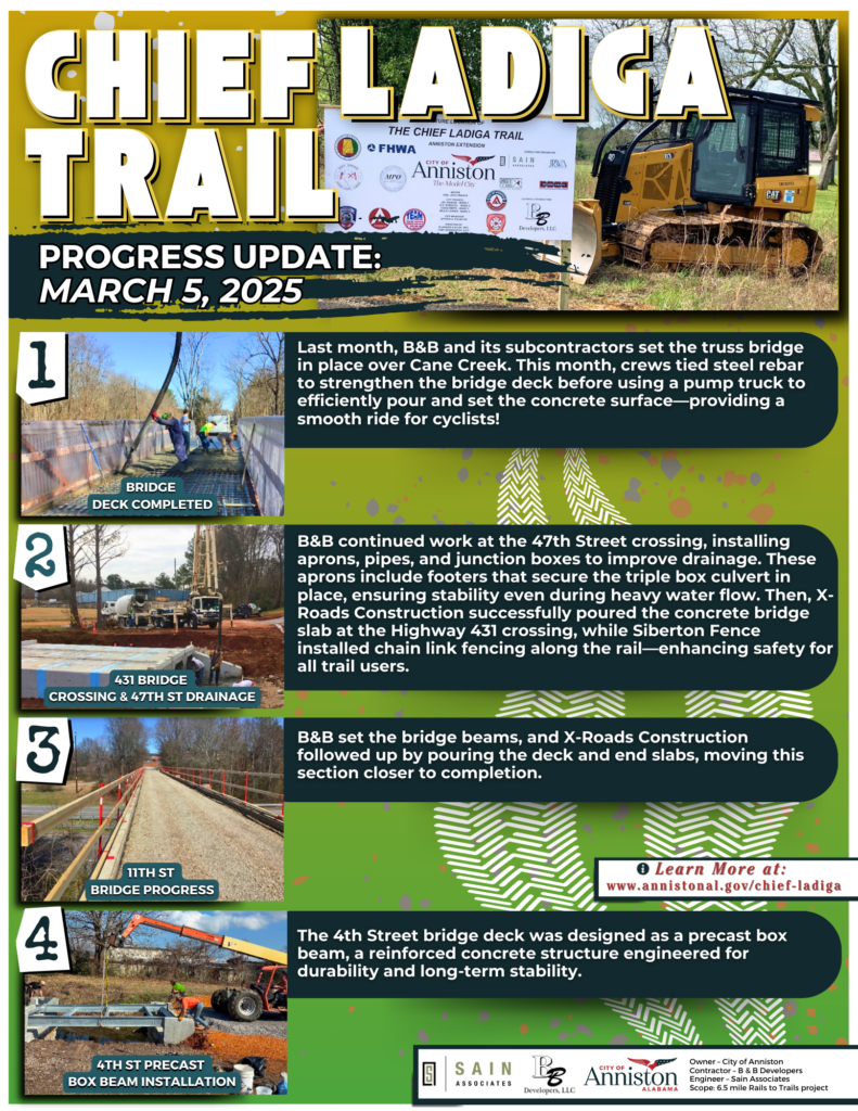
Update – March 5, 2025: B&B continued work at the 47th Street crossing, installing aprons, pipes, and junction boxes to improve drainage. These aprons include footers that secure the triple box culvert in place, ensuring stability even during heavy water flow. Then, X-Roads Construction successfully poured the concrete bridge slab at the Highway 431 crossing, while Siberton Fence installed chain link fencing along the rail—enhancing safety for all trail users. View the full update here.
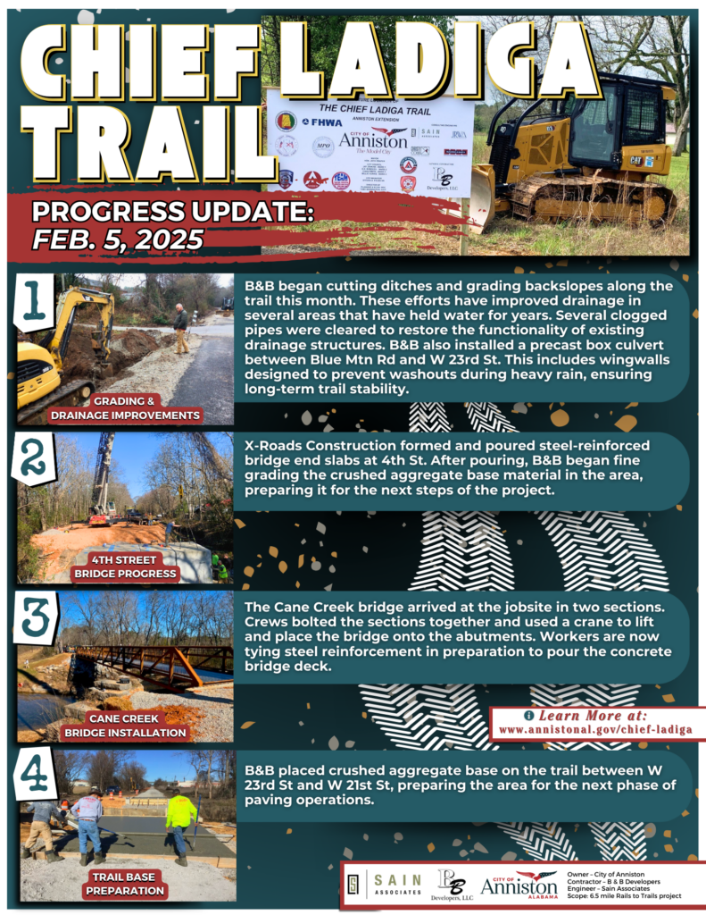
Update – Feb. 5, 2025: The Cane Creek bridge arrived at the jobsite in two sections. Crews bolted the sections together and used a crane to lift and place the bridge onto the abutments. Workers are now tying steel reinforcement in preparation to pour the concrete bridge deck. Click here to view the full update.
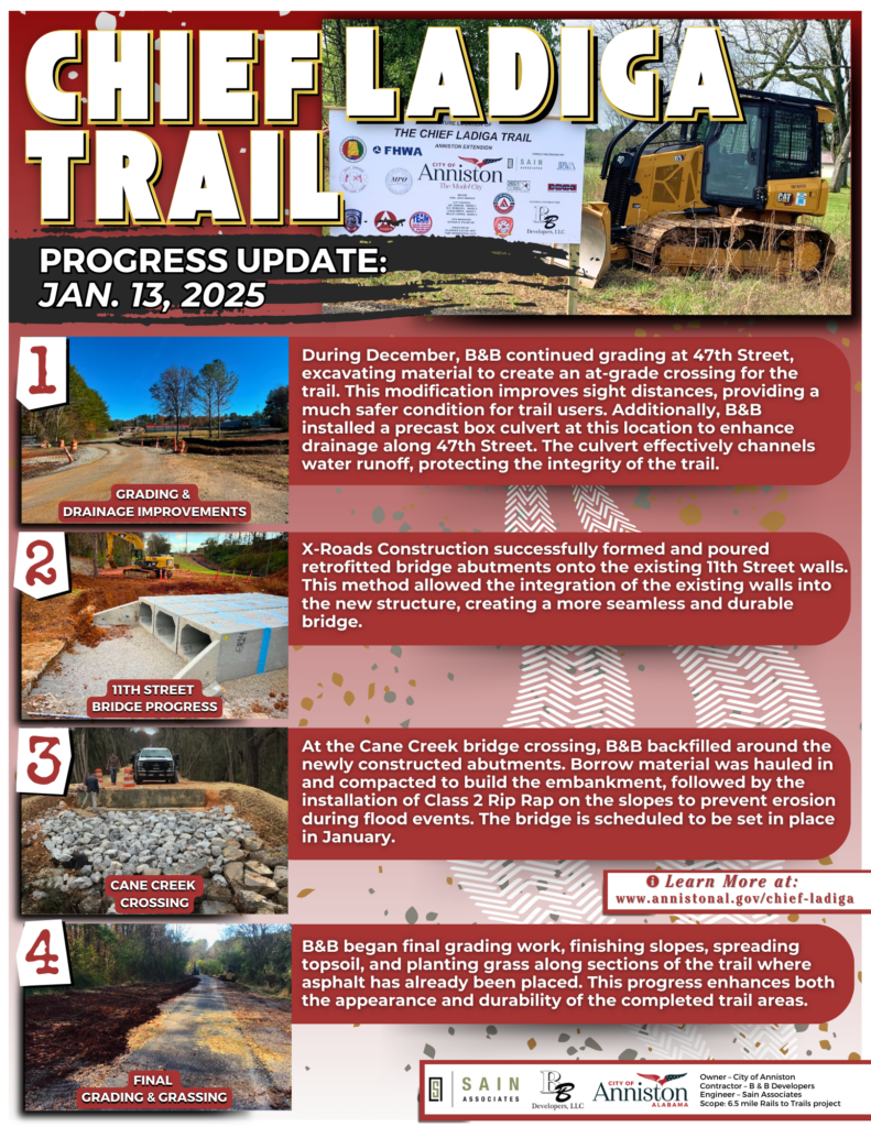
Update – Jan. 13, 2025: B&B began final grading work, finishing slopes, spreading topsoil, and planting grass along sections of the trail where asphalt has already been placed. This progress enhances both the appearance and durability of the completed trail areas. View the full update here.
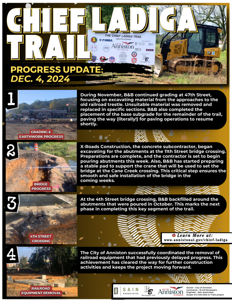
Update – Dec. 4, 2024: During November, B&B continued grading at 47th Street, focusing on excavating material from the approaches to the old railroad trestle. Unsuitable material was removed and replaced in specific sections. B&B also completed the placement of the base subgrade for the remainder of the trail, paving the way (literally!) for paving operations to resume shortly. Click here to view the full update.
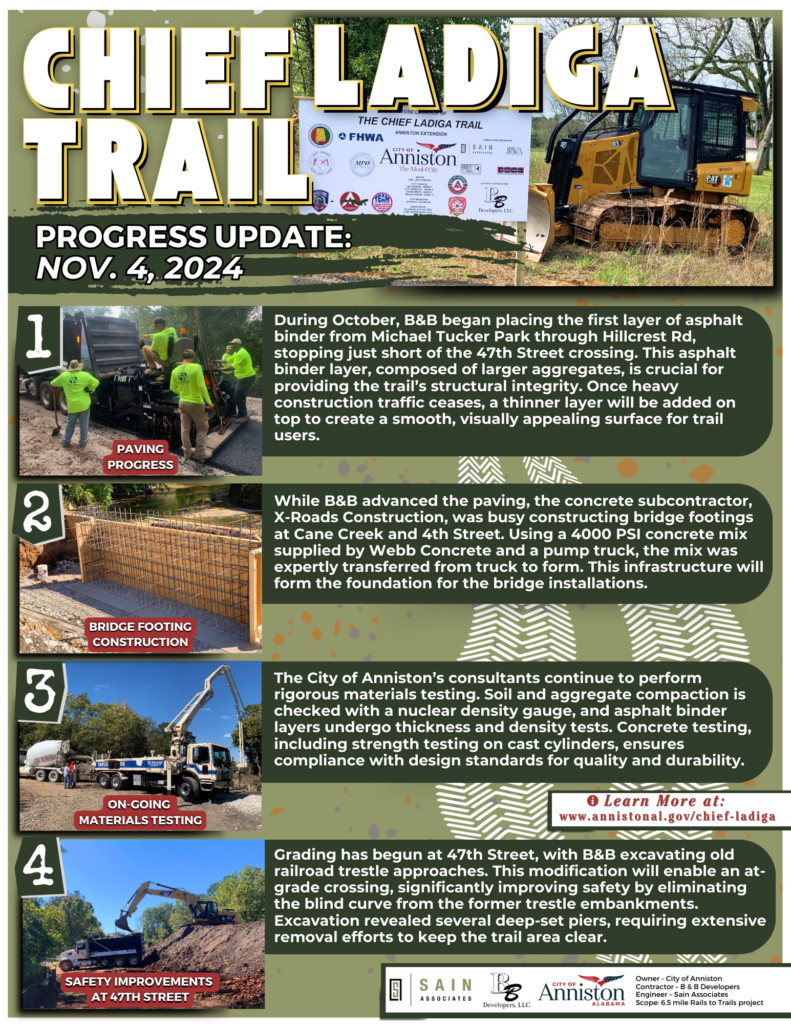
Update – Nov. 4, 2024: During October, B&B began placing the first layer of asphalt binder from Michael Tucker Park through Hillcrest Rd, stopping just short of the 47th Street crossing. This asphalt binder layer, composed of larger aggregates, is crucial for providing the trail’s structural integrity. Once heavy construction traffic ceases, a thinner layer will be added on top to create a smooth, visually appealing surface for trail users. View the full update here.
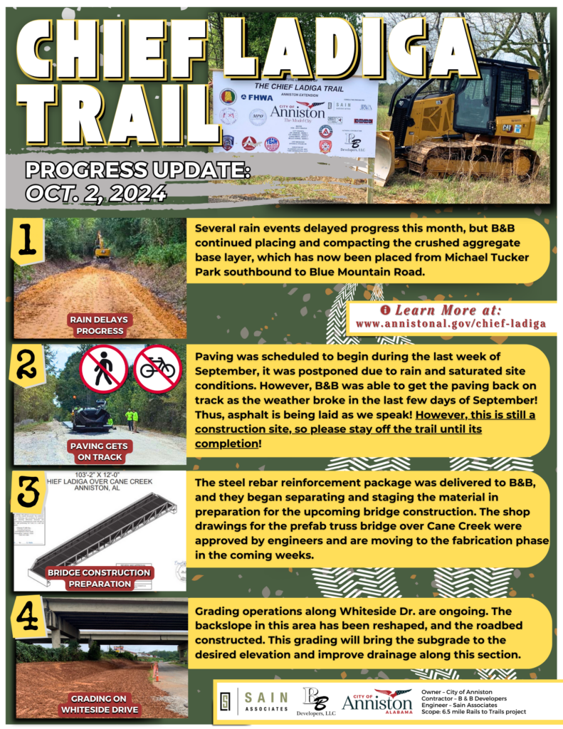
Update – Oct. 2, 2024: Paving was scheduled to begin during the last week of September, it was postponed due to rain and saturated site conditions. However, B&B was able to get the paving back on track as the weather broke in the last few days of September! Thus, asphalt is being laid as we speak! However, this is still a construction site, so please stay off the trail until its completion! B&B also began separating and staging the material in preparation for the upcoming bridge construction. Click here to view the full update.
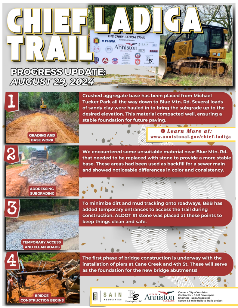
Update – August 29, 2024: The first phase of bridge construction is underway with the installation of helical piers at Cane Creek and 4th Street. These piers will serve as the foundation for the new bridge abutments. We’re making steady progress and appreciate the public’s continued patience and support as we work to enhance this vital community resource! View the full update here.
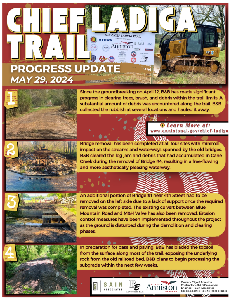
Update – May 29, 2024: Bridge removal has been completed at all four sites with minimal impact on the streams and waterways spanned by the old bridges. B&B cleared the log jam and debris that had accumulated in Cane Creek during the removal of Bridge #4, resulting in a free-flowing and more aesthetically pleasing waterway. View the full update here.
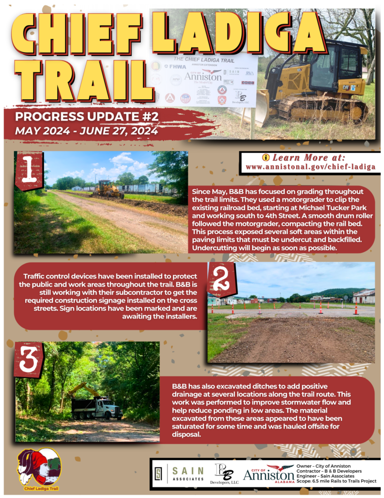
Update – June 27, 2024: Since May, B&B has focused on grading throughout the trail limits. They used a motorgrader to clip the existing railroad bed, starting at Michael Tucker Park and working south to 4th Street. Traffic control devices have been installed to protect the public and work areas throughout the trail. B&B is still working with their subcontractor to get the required construction signage installed on the cross streets. B&B has also excavated ditches to add positive drainage at several locations along the trail route. This work was performed to improve stormwater flow and help reduce ponding in low areas. The material excavated from these areas appeared to have been saturated for some time and was hauled offsite for disposal. View the full update here.
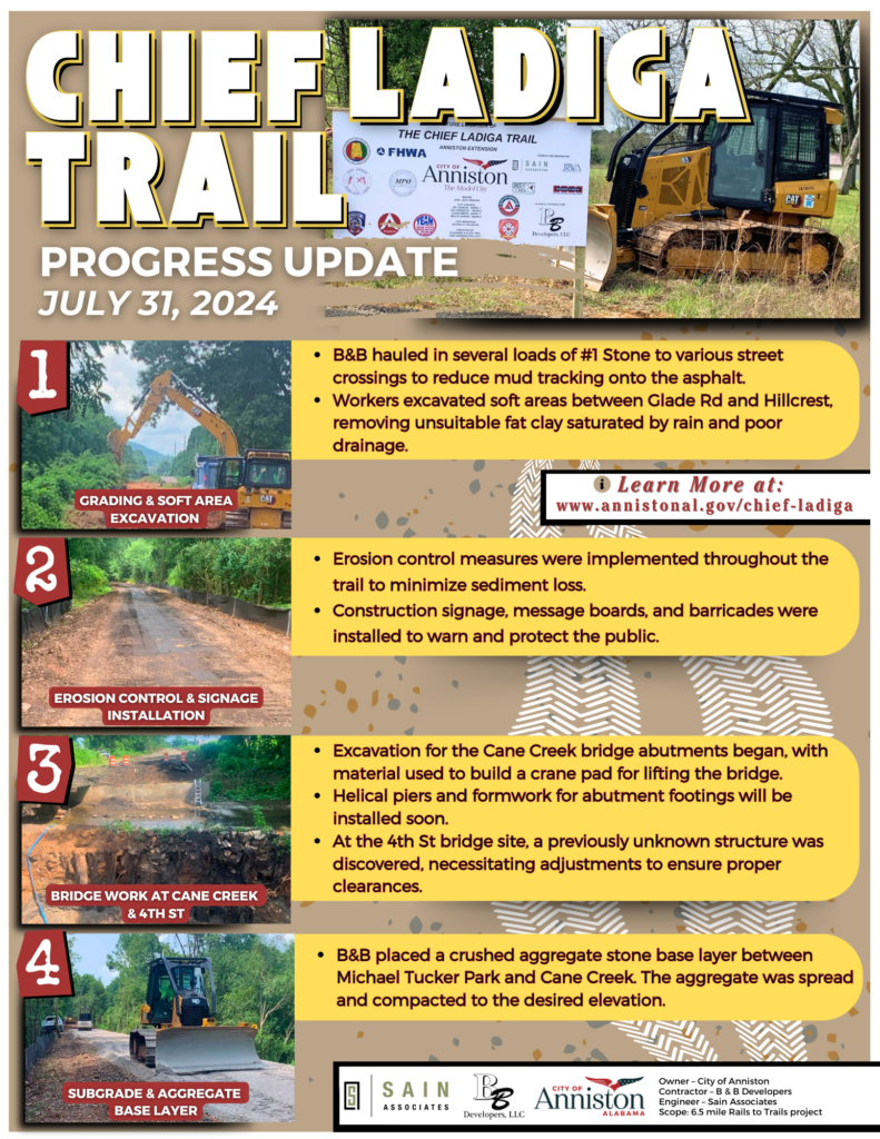
Update – July 31, 2024: During the month of July, B&B has made significant progress on the grading phase along the trail limits, particularly focusing on the south end of the project. You may view the full update here.
The Chief Ladiga Trail began in 1990 when the City of Piedmont received a Land and Water Conservation Grant to purchase the unused rail corridor through Piedmont and Cleburne County. In the early 1990s, Piedmont secured an Intermodal Surface Transportation Enhancement Act (ISTEA) grant from ALDOT to begin trail construction. In 1994, additional ISTEA grants were awarded to Jacksonville, Piedmont, and the Cleburne County Commission for land acquisition and trail development. By 1997, Jacksonville and Anniston received National Recreational Trails Funds (NRT) to construct their sections of the trail. The City of Weaver joined the effort in 1998, securing an ISTEA grant from ALDOT to complete its portion.
In December 2008, the final segment in Cleburne County was completed, officially connecting the Chief Ladiga Trail with the Silver Comet Trail at the Alabama-Georgia state line. Throughout its development, the project received continuous support from the Northeast Alabama Bicycle Association (NEABA) and the Calhoun County Commission. More recently, in 2022, Anniston purchased the final 1.4-mile section needed from Norfolk Southern Railway for the trail’s final extension. On February 20, 2024, the Anniston City Council awarded the construction bid for the Chief Ladiga Trail to B&B Developers for $7,267,263.39.

|